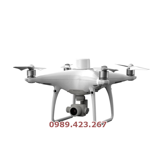
Máy Bay Khảo Sát UAV Phantom 4 RTK
0 ₫
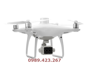
DJI PHANTOM 4 RTK cung cấp giải pháp trắc đạc tối ưu cho doanh nghiệp.
Phantom 4 Pro RTK là một máy bay không người lái có khả năng thu thập dữ liệu trắc đặc chính xác.
PT4 RTK còn có một mức giá thấp hơn, sử dụng hỗ trợ từ ứng dụng chuyên dụng mới.
Giới thiệu
Máy Bay Khảo Sát UAV Phantom 4 RTK là một trong những sản phẩm của DJI – nhà sản xuất hàng đầu về thiết bị bay không người lái. Với thiết kế chuyên nghiệp và tính năng tiên tiến, máy bay này được sử dụng trong nhiều lĩnh vực khác nhau như địa chính, khảo sát địa hình, xây dựng, nông nghiệp, khai thác khoáng sản, v.v. Dưới đây là một số ưu điểm nổi bật của Phantom 4 RTK:
- Độ chính xác cao: Được trang bị bộ định vị RTK (Real Time Kinematics) và cảm biến đo khoảng cách, giúp đạt được độ chính xác lên đến 2-3 cm. Điều này giúp giảm thiểu sai số trong quá trình thu thập dữ liệu và cải thiện độ chính xác của kết quả khảo sát.
- Tầm bay xa và thời gian bay lâu: Có thời gian bay lên đến 30 phút và tầm bay lên đến 7 km, giúp người dùng thu thập dữ liệu trên diện tích rộng lớn và tiết kiệm thời gian, chi phí.
- Cảm biến hình ảnh chất lượng cao: Được trang bị cảm biến hình ảnh 1-inch CMOS với độ phân giải lên đến 20MP và khả năng quay video 4K 60fps, giúp thu thập dữ liệu với độ sâu màu sắc và độ phân giải cao. Bên cạnh đó, máy bay còn được trang bị các cảm biến khác như cảm biến ánh sáng và cảm biến gió, giúp cải thiện chất lượng dữ liệu thu thập.
- Thiết kế nhỏ gọn và tiện lợi: Có thiết kế nhỏ gọn, giúp người dùng dễ dàng mang theo và lắp đặt. Máy bay còn được trang bị tay điều khiển cầm tay, cho phép người dùng dễ dàng kiểm soát máy bay và thu thập dữ liệu trên địa hình khác nhau.
- Tính năng an toàn và tiện lợi: Có nhiều tính năng an toàn và tiện lợi như đánh dấu điểm đến, phát hiện và tránh vật cản, hệ thống khắc phục lỗi tự động và hệ thống
Thông số kỹ thuật Phantom 4 RTK SPECS AIRCRAFT
| Takeoff Weight | 1391 g |
|---|---|
| Diagonal Distance | 350 mm |
| Max Service Ceiling Above Sea Level | 19685 ft (6000 m) |
| Max Ascent Speed | 6 m/s (automatic flight); 5 m/s (manual control) |
| Max Descent Speed | 3 m/s |
| Max Speed |
31 mph (50 kph)(P-mode) 36 mph (58 kph)(A-mode) |
| Max Flight Time | Approx. 30 minutes |
| Operating Temperature Range | 32° to 104° F (0° to 40℃) |
| Operating Frequency |
2.400 GHz to 2.483 GHz (Europe, Japan, Korea) 5.725 GHz to 5.850 GHz (United States, China) |
| Transmission Power (EIRP) |
2.4 GHz CECE (Europe) / MIC (Japan) / KCC (Korea) :< 20 dBm5.8 GHz SRRC(China) / FCC(United States)/(Taiwan,China):< 26 dBm |
| Hover Accuracy Range |
RTK enabled and functioning properly: Vertical:±0.1 m;Horizontal:±0.1 mRTK disabled Vertical:±0.1 m(with vision positioning );±0.5 m(with GNSS positioning) Horizontal:±0.3 m(with vision positioning);±1.5 m(with GNSS positioning) |
| Image Position Offset | The position of the camera center is relative to the phase center of the onboard D-RTK antennaunder the aircraft body’s axis:(36, 0, and 192 mm) already applied to the image coordinates in Exif data. The positive x, y, and z axes of the aircraft body point to the forward, rightward, and downward of the aircraft, respectively. |
MAPPING FUNCTIONS
| Mapping Accuracy ** |
Mapping accuracy meets the requirements of the ASPRS Accuracy Standards for Digital Orthophotos Class Ⅲ ** The actual accuracy depends on surrounding lighting and patterns, aircraft altitude, mapping software used, and other factors when shooting. |
|---|---|
| Ground Sample Distance(GSD) |
(H/36.5) cm/pixel,H means the aircraft altitude relative to shooting scene (unit: m) |
| Data Acquisition Efficiency |
Max operating area of approx. 1 km² for a single flight(at an altitude of 182 m, i.e., GSD is approx. 5 cm/pixel, meeting the requirements of the ASPRS Accuracy Standards for Digital Orthophotos Class Ⅲ |
VISION SYSTEM
| Velocity Range |
≤31 mph(50 kph) at 6.6 ft(2 m) above ground with adequate lighting |
|---|---|
| Altitude Range |
0-33 ft(0 – 10 m) |
| Operating Range |
0-33 ft(0 – 10 m) |
| Obstacle Sensing Range |
2-98 ft(0.7-30 m) |
| FOV |
Forward/Rear: 60° (horizontal), ±27° (vertical) Downward: 70° (front and rear), 50° (left and right) |
| Measuring Frequency |
Forward/Rear:10 Hz; Downward: 20 Hz |
| Operating Environment | Surfaces with clear patterns and adequate lighting(> 15 lux) |
CAMERA
| Sensor | 1″ CMOS; Effective pixels: 20 M |
|---|---|
| Lens | FOV 84°;8.8 mm / 24 mm(35 mm format equivalent:24 mm);
f/2.8 – f/11, auto focus at 1 m – ∞ |
| ISO Range | Video:100-3200(Auto)
100-6400(Manual);Photo:100-3200(Auto)100-12800(Manual) |
| Mechanical Shutter Speed | 8 – 1/2000 s |
| Electronic Shutter Speed | 8 – 1/8000 s |
| Max Image Size | 4864×3648(4:3);
5472×3648(3:2) |
| Video Recording Modes | H.264,4K:3840×2160 30p |
| Photo Format | JPEG |
| Video Format | MOV |
| Supported File Systems | FAT32(≤ 32 GB);
exFAT(> 32 GB) |
| Supported SD Cards | MicroSD, Max Capacity: 128 GB. Class 10 or UHS-1 rating required Write speed≥15 MB/s |
| Operating Temperature Range | 32° to 104° F (0° to 40℃) |
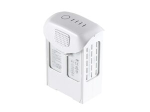
INTELLIGENT FLIGHT BATTERY(PH4-5870MAH-15.2V)
| Capacity | 5870 mAh |
|---|---|
| Voltage | 15.2 V |
| Battery Type | LiPo 4S |
| Energy | 89.2 Wh |
| Net Weight | 468 g |
| Charging Temperature Range | 14° to 104℉(-10° to 40℃) |
| Max charging Power | 160 W |
INTELLIGENT BATTERY CHARING HUB(WCH2)
| Input Voltage | 17.3 – 26.2 V |
|---|---|
| Output Voltage and Current | 8.7 V,6 A;5 V,2 A |
| Operating Temperature | 41° to 104℉(5° to 40℃) |
GNSS
| Single-Frequency, High-Sensitivity GNSS Module | GPS+BeiDou+Galileo(Asia);
GPS+GLONASS+Galileo(other regions) |
|---|---|
| Multi-Frequency Multi-System High-Precision RTK GNSS | Frequency Used:
GPS:L1/L2; GLONASS:L1/L2; BeiDou:B1/B2; Galileo:E1/E5aFirst-Fixed Time:< 50 sPositioning Accuracy: Vertical 1.5 cm + 1 ppm(RMS); Horizontal 1 cm + 1 ppm(RMS)1 ppm means the error has a 1mm increase for every 1 km of movement from the aircraft. |
GIMBAL
| Stabilization | 3-axis (tilt, roll, yaw) |
|---|---|
| Pitch | -90° to +30° |
| Max Controllable Angular Speed | 90°/s |
| Angular Vibration Range | ±0.02° |
INFRARED
| Obstacle Sensing Range | 0.6-23 ft(0.2 – 7 m) |
|---|---|
| FOV | 70°(Horizontal) ±10°(Vertical) |
| Measuring Frequency | 10 Hz |
| Operating Environment | Surface with diffuse reflection material, and reflectivity> 8%(such as wall,trees, humans, etc.) |
REMOTE CONTROLLER
| Operating Frequency | 2.400 GHz-2.483 GHz(Europe,Japan,Korea)
5.725 GHz-5.850 GHz(United States, China) |
|---|---|
| Transmission Power (EIRP) | 2.4 GHz
CE / MIC / KCC:< 20 dBm5.8 GHz SRRC / FCC:< 26 dBm |
| Max Transmission Distance | FCC:4.3 mi(7 km);
SRRC / CE / MIC / KCC:3.1 mi(5 km) (Unobstrcted, free of interference) |
| Power Consumption | 16 W(typical value) |
| Display | 5.5 inch screen, 1920×1080, 1000 cd/m², Android System Memory 4G RAM+16G ROM |
| Operating Temperature Range | 32° to 104° F (0° to 40℃) |
INTELLIGENT FLIGHT BATTERY CHARGING HUB(PHANTOM 4 CHARING HUB)
| Voltage | 17.5 V |
|---|---|
| Operating Temperature Range | 41° to 104℉(5° to 40℃) |
| Capacity | 4920 mAh |
| Voltage | 7.6 V |
| Battery Type | LiPo 2S |
| Energy | 37.39 Wh |
| Operating Temperature | -4° to 104℉(-20° to 40℃) |
AC POWER ADAPTER(PH4C160)
| Voltage | 17.4 V |
|---|---|
| Rated Power | 160 W |


Đánh giá Máy Bay Khảo Sát UAV Phantom 4 RTK